Amazonis quadrangle
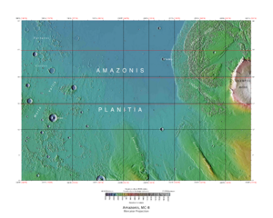
The Amazonis quadrangle is one of a series of 30 quadrangle maps of Mars used by the United States Geological Survey (USGS) Astrogeology Research Program . The Amazonis quadrangle is also referred to as MC-8 (Mars Chart-8). [1]
Page Revisions
| Year | Metadata | Sections | Top Words | First Paragraph |
| 2018 |
184925 characters 15 sections 103 paragraphs 91 images 289 internal links 31 external links |
hiwish 0.450 hirise 0.371 program 0.242 amazonis 0.218 streaks 0.214 yardangs 0.213 medusae 0.179 layers 0.163 sulci 0.159 ridges 0.152 view 0.145 slope 0.132 dark 0.129 dust 0.117 fossae 0.113 |
The Amazonis quadrangle is one of a series of 30 quadrangle maps of Mars used by the United States Geological Survey (USGS) Astrogeology Research Program . The Amazonis quadrangle is also referred to as MC-8 (Mars Chart-8). [1] |
|
| 2017 |
173078 characters 15 sections 91 paragraphs 79 images 289 internal links 29 external links |
hiwish 0.404 hirise 0.351 amazonis 0.247 streaks 0.242 program 0.218 sulci 0.181 yardangs 0.172 medusae 0.172 layers 0.172 ridges 0.154 slope 0.150 dark 0.146 dust 0.122 fossae 0.108 streamlined 0.107 |
The Amazonis quadrangle is one of a series of 30 quadrangle maps of Mars used by the United States Geological Survey (USGS) Astrogeology Research Program . The Amazonis quadrangle is also referred to as MC-8 (Mars Chart-8). [1] |
|
| 2016 |
160993 characters 15 sections 76 paragraphs 67 images 274 internal links 26 external links |
hiwish 0.352 hirise 0.326 amazonis 0.275 streaks 0.257 yardangs 0.211 sulci 0.201 program 0.191 medusae 0.173 slope 0.156 dark 0.150 craters 0.121 streamlined 0.119 gordii 0.117 lycus 0.117 ridges 0.111 |
The Amazonis quadrangle is one of a series of 30 quadrangle maps of Mars used by the United States Geological Survey (USGS) Astrogeology Research Program . The Amazonis quadrangle is also referred to as MC-8 (Mars Chart-8). [1] |
|
| 2015 |
128186 characters 11 sections 48 paragraphs 41 images 244 internal links 26 external links |
amazonis 0.304 streaks 0.286 hirise 0.226 sulci 0.218 medusae 0.212 yardangs 0.182 dark 0.168 craters 0.158 slope 0.156 hiwish 0.146 columnar 0.144 jointing 0.144 airblast 0.138 fossae 0.133 pedestal 0.122 |
The Amazonis quadrangle is one of a series of 30 quadrangle maps of Mars used by the United States Geological Survey (USGS) Astrogeology Research Program . The Amazonis quadrangle is also referred to as MC-8 (Mars Chart-8). [1] |
|
| 2014 |
110802 characters 9 sections 37 paragraphs 35 images 238 internal links 17 external links |
sulci 0.306 amazonis 0.262 medusae 0.232 hirise 0.207 columnar 0.203 jointing 0.203 craters 0.174 pedestal 0.171 ejecta 0.150 fossae 0.146 furrows 0.145 lycus 0.134 mons 0.132 erosion 0.113 hiwish 0.112 |
The Amazonis quadrangle is one of a series of 30 quadrangle maps of Mars used by the United States Geological Survey (USGS) Astrogeology Research Program . The Amazonis quadrangle is also referred to as MC-8 (Mars Chart-8). [1] |
|
| 2013 |
98172 characters 8 sections 32 paragraphs 32 images 238 internal links 13 external links |
sulci 0.333 amazonis 0.285 medusae 0.252 columnar 0.220 jointing 0.220 hirise 0.199 pedestal 0.186 ejecta 0.163 fossae 0.158 furrows 0.157 lycus 0.146 mons 0.144 erosion 0.123 formation 0.121 olympus 0.118 |
The Amazonis quadrangle is one of a series of 30 quadrangle maps of Mars used by the United States Geological Survey (USGS) Astrogeology Research Program . The Amazonis quadrangle is also referred to as MC-8 (Mars Chart-8). [1] |
|
| 2012 |
93785 characters 7 sections 30 paragraphs 29 images 236 internal links 11 external links |
sulci 0.336 medusae 0.254 columnar 0.222 jointing 0.222 amazonis 0.215 hirise 0.201 pedestal 0.188 ejecta 0.164 fossae 0.160 furrows 0.159 lycus 0.147 mons 0.145 erosion 0.124 formation 0.122 olympus 0.119 |
The Amazonis quadrangle is one of a series of 30 quadrangle maps of Mars used by the United States Geological Survey (USGS) Astrogeology Research Program . The Amazonis quadrangle is also referred to as MC-8 (Mars Chart-8). [1] |
|
| 2011 |
39655 characters 7 sections 25 paragraphs 20 images 86 internal links 6 external links |
sulci 0.345 columnar 0.261 jointing 0.261 medusae 0.213 amazonis 0.211 hirise 0.188 furrows 0.186 pedestal 0.176 lycus 0.173 ejecta 0.144 olympus 0.139 furrow 0.139 fossae 0.134 craters 0.124 streaks 0.115 |
The Amazonis quadrangle is one of a series of 30 quadrangle maps of Mars used by the United States Geological Survey (USGS) Astrogeology Research Program . The Amazonis quadrangle is also referred to as MC-8 (Mars Chart-8). [1] |
|
| 2010 |
35270 characters 7 sections 23 paragraphs 18 images 83 internal links 5 external links |
sulci 0.364 jointing 0.276 amazonis 0.223 columnar 0.207 furrows 0.197 lycus 0.183 hirise 0.183 medusae 0.180 olympus 0.147 furrow 0.147 pedestal 0.140 ejecta 0.127 streaks 0.121 pettit 0.118 fissure 0.115 |
The Amazonis quadrangle is one of a series of 30 quadrangle maps of Mars used by the United States Geological Survey (USGS) Astrogeology Research Program . The Amazonis quadrangle is also referred to as MC-8 (Mars Chart-8). [1] |
|
| 2009 |
27551 characters 5 sections 20 paragraphs 16 images 76 internal links 2 external links |
sulci 0.419 amazonis 0.256 columnar 0.237 jointing 0.237 furrows 0.226 lycus 0.210 hirise 0.210 olympus 0.169 furrow 0.169 medusae 0.155 streaks 0.140 pettit 0.136 fissure 0.132 nicholson 0.132 marte 0.122 |
The Amazonis quadrangle covers the area from 135° to 180° west longitude and 0° to 30° north latitude on Mars . This area is considered to be among the youngest parts of Mars because it has a very low density of craters. The Amazonia age is named after this area. |